Utility asset data capture & management solution
MGISS are releasing a low-cost solution that has been designed to support utility organisations in the capture, management, and use of asset data records.
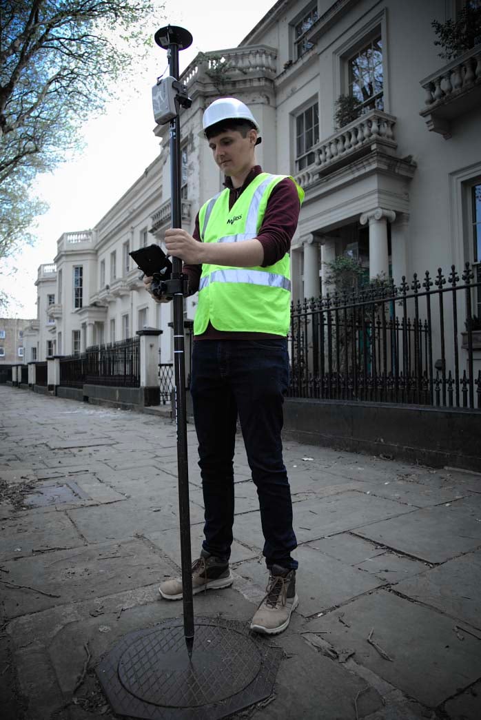
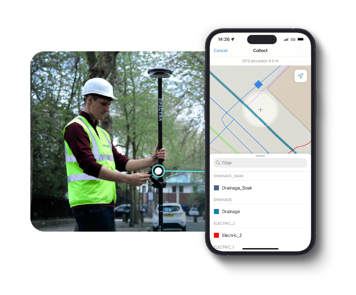
Delivering sub 10cm absolute accuracy levels we are offering the Leica Geosystems FLX100 plus Smart Antenna, SmartNet sub 10 cm correction service and MGISS’s mobile operations workflow for NUAR which has been built on the leading GIS from Esri for just £9,995 + VAT.
And if you're interested in adding reality capture to the package, a vGIS license with a LiDAR module is an additional £1,500 + VAT.
Leica Zeno FLX100 plus

Compact, rugged and lightweight, the Leica Zeno FLX100 plus smart antenna is your dependable data capture solution delivering 10 cm accuracy.
Hexagon SmartNet

HxGN SmartNet is the most dense reference station in the UK. By using our data-enabled multi-network SIM card, you can achieve complete coverage across all mobile networks.
Get NUAR ready

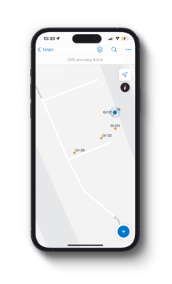
Get NUAR ready with our Esri Field Maps workflow which has been built on the leading GIS from Esri.
Case study

“MGISS have been a key partner to helping provide EAN & P with the necessary skills, knowledge and regular interface meetings to capture and vectorise our electric cables and gas pipes throughout London in line with the NUAR requirements."
Andrew Collin, Network Manager at Energy Assets Networks and Pipelines
85%
of their time was saved
50%
less resources were needed
3 years
worth of surveying completed in just 6 months
Our hardware solutions

Arrow Gold+
High-accuracy Bluetooth GNSS receiver supporting all global constellations and RTK augmentation. Works seamlessly on iOS, Android, and Windows devices, with full-band support for Galileo High-Accuracy Service (HAS).

GG04 Plus
Compact smart antenna uses RTK technology for real-time high-accuracy data collection, even in challenging locations without a mobile data connection. Lightweight with durable design.

FLX100
Precise location accuracy on iOS, Android, and Windows with the Leica Zeno FLX100 Smart Antenna. Capture spatial data effortlessly and pair with your smartphone or tablet for flexible, customised work.
Arrow 100
Submeter GNSS receiver for iOS, Android, or Windows. Utilises GLONASS, Galileo, and BeiDou signals, accessing at least 100 satellites. Uniquely maximises accuracy from free SBAS corrections.
About NUAR
The Geospatial Commission, part of the Department for Science, Innovation and Technology, is building a digital map of underground pipes and cables that will revolutionise the way we install, maintain, operate, and repair our buried infrastructure - the National Underground Asset Register (NUAR).
Once operational, NUAR is envisaged to deliver £490 million per year of economic growth through increased efficiency, reduced asset strikes (when underground pipes and cables are accidentally damaged) and reduced disruptions for the public and businesses.
The emerging service is improving the efficiency and safety of underground works by providing secure access to privately and publicly owned location data about the pipes and cables beneath our feet. The digital map gives planners and excavators standardised access to the data they need, when they need it, to carry out their work effectively and safely. It also includes features to keep data secure and improve its quality over time.
An initial private BETA version of NUAR, also called the ‘minimum viable product’ (MVP), is live across England and Wales. The MVP includes all core functionality to meet the ‘safe dig’ use case, allowing users to both plan for future adoption and provide valuable feedback to enhance the service further. It includes data from all of the major energy and water providers, such as Welsh Water, Cadent Gas and UK Power Networks, several major telecommunications companies, including CityFibre and Virgin Media O2, as well as smaller providers of these services, transport organisations and local authorities. Find more about the NUAR ‘MVP’.
Could you benefit from any of the following?
Reliable Highways Maintenance
Providing peace of mind, our solutions provide
asset managers with unparalleled accuracy, anticipating issues and preventing failures before they happen.
Tailored for Precise Predictions
More than tools, our solutions are problem-solving assets, swiftly addressing potential issues and effortlessly ensuring up-to-date data for asset managers.
Quality Investment at Transparent Prices
Setting new standards in reliability, our solutions guarantee accuracy and reliability at transparent prices, safeguarding vital road networks and offering invaluable assets for your business.
Trusted Expertise and Unparalleled Solutions
As your trusted partner, we offer expertise and solutions that blend accuracy and reliability, driving efficiency and confidence in highway maintenance.
YOUR ASSETS MEET OUR PRECISION
We don't just offer reliability - we embody it, supplying your business with hardware synonymous with simplicity, compatibility, and unwavering trust. We work relentlessly to ensure our solutions stand the test of time, enabling the dependable and fully future-proofed performance of your assets.
YOUR CHALLENGES MEET OUR EXPERTISE
At MGISS, we're not just your experts; we're the geo-spatial authority. When it comes to finding the right solution for your business, we’re the only partner you need to help you overcome asset management obstacles. Recognised by our clients as knowledge leaders, we’ve been setting the industry standard for over a decade.
YOUR REQUIREMENTS MEET OUR CONFIGURATION
Our commitment to quality doesn't just meet industry standards; it promises to exceed your business expectations. Discover tailored, high-quality solutions crafted to seamlessly meet your unique needs. We prioritise configuration over custom development to future-proof your setup – meaning you can count on us to empower you by ensuring timely project delivery, every time.
YOUR QUESTIONS MEET OUR SUPPORT
Customer service isn't just a department, it's our commitment. Whether you seek virtual training, face-to-face sessions, or real-time remote assistance, our support team is here for you. Expect prompt, efficient, and warm responses, with your every query addressed swiftly to keep you operational and thriving, wherever you are.
YOUR GREEN STRATEGY MEETS OUR PURPOSE
Our commitment to decarbonisation is fierce, using solutions that encourage sustainability by improving efficiency and data quality, and simultaneously reduce emissions and waste. Led by precise, reliable data - we act with intention to deliver real impact, enhancing digital workforce proficiency to move your business towards a greener future.
%20(1).jpeg)
%20(1).jpeg)




.jpeg?width=1342&height=2000&name=Leica_Zeno_FLX100_Plus_Image%20(65).jpeg)